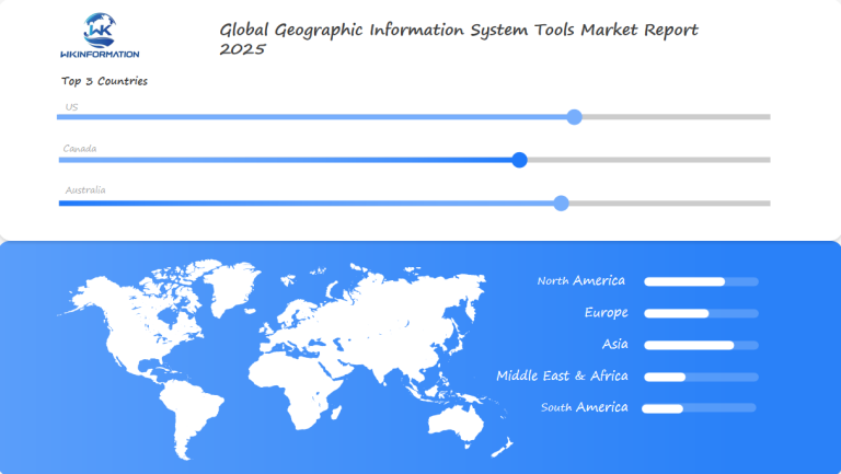
Geographic Information System Tools Market Anticipated to Reach $2.46 Billion by 2025: Insights from the U.S., Canada, and Australia
Explore the evolving Geographic Information System Tools Market, driven by technological advancements, rising demand for spatial data analysis, and integration with cloud computing platforms.
- Last Updated:
Geographic Information System Tools Market Q1 and Q2 of 2025 Forecast and Regional Insights
The Geographic Information System (GIS) Tools market is forecasted to reach $2.46 billion in 2025, with an impressive CAGR of 11.04% through 2033. Market activity in early 2025 is expected to be uneven, with Q1 revenues around $525 million, increasing to $620 million in Q2. This growth is propelled by expanding applications in urban planning, agriculture, and disaster management.

Key Takeaways
- The GIS market is expected to reach $2.46 billion by 2025.
- There is an increasing demand for spatial data analysis across industries.
- Technological advancements are driving geospatial innovation.
- GIS plays a critical role in decision-making for businesses and governments.
- There is a growing investment in advanced mapping technologies.
Understanding the Software Development and Data Providers in the GIS Industry
The GIS industry is a complex world of software and data. It drives innovation and spatial intelligence. Understanding this ecosystem helps us keep up with geospatial technology changes.
GIS software providers play a crucial role in transforming raw data into valuable insights. They develop tools that enable professionals to analyze and visualize geographic data with precision.
Key Players in GIS Software Development
Top GIS software providers lead the market with their innovative products:
- Esri – Market leader with comprehensive mapping solutions
- Autodesk – Specialized geospatial design software
- Google – Cloud-based mapping technologies
- Hexagon – Enterprise-level geospatial platforms
Data Collection and Integration Processes
Geospatial data sources are vital for the industry. They include satellite images, ground surveys, and crowdsourced data. Combining these data types needs advanced processing.
| Data Source Type | Collection Method | Primary Applications |
| Satellite Imagery | Remote Sensing | Environmental Monitoring |
| LiDAR Scanning | Aerial Laser Mapping | Urban Planning |
| Ground Surveys | GPS Tracking | Infrastructure Development |
By integrating these data sources, companies can create detailed spatial intelligence solutions. These solutions help make strategic decisions in various industries.
Market Trends Driving GIS Adoption Across Industries and Government Sectors
Geographic Information System (GIS) technologies are changing fast across many sectors. The way organizations use spatial data for making big decisions is shifting. Both government agencies and private companies see the value in GIS solutions.
New technologies are making GIS even better. Advances in computing are opening up new ways to analyze geospatial data.
Integration of GIS with Emerging Technologies
Today’s GIS systems use advanced tech to better understand data:
- Artificial Intelligence for predictive spatial modeling
- Internet of Things (IoT) for real-time data collection
- Machine learning algorithms for complex spatial pattern recognition
Sector-Specific GIS Applications
GIS solutions are changing how different industries work:
| Sector | GIS Application | Key Benefits |
| Urban Planning | Infrastructure mapping | Improved resource allocation |
| Environmental Management | Ecosystem monitoring | Conservation strategy development |
| Emergency Services | Risk assessment | Enhanced response coordination |
Government use of GIS is making public services better and more efficient. It helps in managing resources wisely. Companies find that using spatial intelligence gives them deep insights into big challenges.
Regulatory Restrictions Ensuring Data Privacy and Compliance Standards
The world of Geographic Information Systems (GIS) is changing fast. There’s a big push for strong data privacy and geospatial compliance rules. Companies and governments must deal with tough rules to keep sensitive data safe and work well.
Keeping geospatial data safe is now a big deal for businesses and government. The rules for handling geographic data are getting more complex. This means companies need strong plans to handle risks.
Data Protection Regulations Impacting GIS
Important rules for GIS data privacy include:
- General Data Protection Regulation (GDPR)
- California Consumer Privacy Act (CCPA)
- Health Insurance Portability and Accountability Act (HIPAA)
- International geospatial data sharing protocols
Industry-Specific Compliance Requirements
Different fields face unique challenges in keeping GIS data safe. Healthcare, defense, and urban planning need special ways to protect geographic info.
Companies must use advanced methods like:
- Data encryption techniques
- Anonymization of geospatial datasets
- Strict access control mechanisms
- Regular compliance audits
The future of GIS will mix new tech with strict data protection. Companies that succeed will have strong rules to protect data and still do important spatial analysis.

Geopolitical Influences Affecting Data Access and International Collaboration
The world of geospatial data faces big challenges in sharing and working together across borders. Nations struggle with how to share spatial information safely and effectively.
Sharing geographic data between countries is hard. This is because of many reasons:
- National security concerns
- Data privacy regulations
- Proprietary technology restrictions
- Economic competitive interests
Cross-Border Data Sharing Challenges
Sharing data internationally requires careful discussions and technical solutions. Each country has its own methods of protecting geospatial data, which poses challenges for global projects.
Global Initiatives for Geospatial Cooperation
Many groups are trying to solve these problems. The United Nations Global Geospatial Information Management (UN-GGIM) is key in setting up ways to work together.
| Organization | Primary Focus | Key Collaborative Efforts |
| UN-GGIM | Global Data Standards | Harmonizing Geospatial Policies |
| International Cartographic Association | Mapping Cooperation | Cross-Border Research Initiatives |
| Open Geospatial Consortium | Technology Integration | Developing Interoperable Platforms |
These efforts show the world’s push to break down political walls. They aim to make sharing spatial data more open and collaborative.
Type Segmentation Covering Desktop, Web-Based, and Mobile GIS Tools
Geographic Information System (GIS) technologies have evolved significantly over time. They now provide various solutions for managing and analyzing spatial data. The primary categories include desktop GIS software, web GIS platforms, and mobile GIS applications.
These tools empower organizations to work with geospatial data in diverse ways. They facilitate mapping and insights across multiple industries.
Features and Applications of Desktop GIS Software
Desktop GIS software is key for deep spatial analysis. It has many features for experts, like:
- Complex spatial data visualization
- Advanced analytical capabilities
- High-performance computational processing
- Detailed cartographic design options
Advantages of Web-Based and Cloud GIS Platforms
Web GIS platforms have changed geospatial tech. They make it easy to access and work together. The main benefits are:
- Real-time data sharing
- Multi-user collaboration
- Scalable infrastructure
- Cost-effective deployment
Mobile GIS Solutions for Field Work
Mobile GIS apps have changed how we collect and analyze data in the field. They let professionals work on the go. This helps in fields like utilities, environmental monitoring, and urban planning.
Using desktop GIS, web GIS, and mobile GIS together helps organizations make better decisions. It also improves how they work.
Application Analysis Focused on Urban Planning, Environmental Monitoring, and Resource Management
Geographic Information Systems (GIS) have changed how we tackle complex spatial issues. They are making cities smarter, helping us understand the environment, and guiding us to make better use of resources.
Smart City Development through GIS
Today’s urban planners use GIS to build smarter cities. These advanced tools help cities:
- Optimize public transportation routes
- Manage infrastructure development
- Analyze population density patterns
- Improve emergency response strategies
Environmental Monitoring Innovations
Environmental GIS tools are key for tracking ecological changes and supporting conservation. Researchers use them to:
- Map habitat transformations
- Track climate change indicators
- Monitor biodiversity shifts
- Predict environmental risks
Sustainable Resource Management
GIS tools help organizations make better decisions about natural resources. They focus on conservation and efficient use.
| Resource Type | GIS Application | Sustainability Impact |
| Water Resources | Watershed mapping | Improved water conservation |
| Forest Management | Vegetation density tracking | Reduced deforestation |
| Agricultural Land | Crop yield prediction | Enhanced food security |
GIS is leading to new innovations in urban planning, environmental protection, and resource management. It’s all about using advanced spatial analysis to make a difference.
Global Overview of GIS Market: Key Regions, Leading Markets, and Technological Innovations
The global GIS market is evolving rapidly. Different regions have their unique approaches to utilizing GIS, highlighting the significant influence of local technology and economies.
When we analyze the global GIS market, we observe substantial variations. Emerging technologies and trends are reshaping our usage of maps and data, creating fresh opportunities for businesses and governments worldwide.
North American GIS Market Dynamics
North America is leading in GIS tech. The US is at the forefront, investing a lot in mapping and data. New research and development are making spatial analytics better.
- Advanced geospatial software development
- Significant government and private sector investments
- High adoption rates across multiple industries
European GIS Adoption Trends
In Europe, GIS is used in a planned way. There’s a focus on standardizing data and working together across borders. The INSPIRE directive has helped make a common data base for all member states.
Asia-Pacific GIS Market Growth
The Asia-Pacific region is growing fast in GIS. Countries like China and India are leading with big projects and smart cities. Fast growth and tech use are driving GIS adoption.
The GIS market is always changing. It shows how important GIS is for solving big problems in different places.
U.S. Leadership in GIS Innovation
The United States leads in Geographic Information System (GIS) technology. It drives global innovation with advanced research and leading companies. The U.S. GIS market is a technological powerhouse, excelling in spatial analysis and geospatial solutions.
American GIS innovation has changed many industries. It has created advanced tools for working with spatial data. Top companies are global leaders, expanding geospatial capabilities.
Key U.S. GIS Companies Driving Innovation
- Esri: Recognized as the world’s leading GIS software provider
- Trimble: Specializing in GPS and positioning technologies
- Hexagon: Developing advanced geospatial solutions
- Google Earth: Providing accessible mapping technologies
Government Initiatives Driving GIS Adoption
Government GIS initiatives have been key in advancing spatial technology in the U.S. The National Spatial Data Infrastructure (NSDI) and the Geospatial Data Act of 2018 support innovation and standardization.
Federal agencies like the U.S. Geological Survey and NASA have been crucial. They invest in research that expands spatial analysis and data integration.
Canada's Expanding Use in Natural Resource Management
The Canadian landscape is key for advanced geospatial infrastructure. Geographic Information Systems (GIS) are changing how we manage natural resources. They help with precise monitoring and planning across different terrains.
Natural resource GIS technologies have changed Canada’s approach to environmental challenges. The country uses the latest spatial analysis to support sustainable development in key sectors.
GIS Applications in Forestry and Mining
Canada’s forestry and mining industries use advanced GIS tools to manage resources better and reduce environmental harm. Some key applications include:
- Monitoring forest health using satellite imagery
- Accurately locating mineral deposits
- Assessing environmental impact
- Planning for sustainable land use
Canadian Geospatial Data Infrastructure
The national geospatial infrastructure lets data share easily among agencies, research, and private sectors. This teamwork improves decision-making and resource management.
There’s a growing trend in geospatial technologies in Canada. This makes Canada a world leader in managing natural resources and protecting the environment.
Australia's Growing Urban and Environmental GIS Applications
The Australian GIS market is growing fast. It’s changing how urban planners and environmental scientists work. New geographic information systems are making big changes in many areas, especially in cities and nature.
Australian cities are using the latest geographic information system technologies. They’re tackling big issues like infrastructure and keeping the environment safe. Urban planning GIS is key for managing growth, building, and adapting to climate change.
Strategic Urban Planning Innovations
Urban planning GIS in Australia is used for many important things:
- Intelligent city mapping and infrastructure optimization
- Predictive urban growth modeling
- Transportation network analysis
- Smart infrastructure development
Environmental Conservation Strategies
Environmental GIS is vital for Australia’s nature management. Experts use advanced tools to:
- Track biodiversity patterns
- Monitor bushfire risk zones
- Analyze climate change impacts
- Manage natural resource preservation
The Foundation Spatial Data Framework (FSDF) helps standardize data. It ensures that data is collected and used well across the country and regions. This makes sure we have accurate and complete spatial information.
Future Development: Emphasizing AI Integration and Real-Time Data
The world of geographic information systems (GIS) is changing fast. New technologies are leading the way. Artificial intelligence and better data handling are making big changes in how we analyze and make decisions.
New AI in GIS is changing how we use geospatial data. Machine learning is getting smarter. It helps us analyze data more accurately and automatically in many fields.
Machine Learning in Spatial Analysis
Machine learning is making spatial analysis better. It’s all about smarter data use. Some big improvements include:
- Automated feature extraction from satellite imagery
- Predictive modeling for urban planning
- Enhanced pattern recognition in complex geographical datasets
Real-Time GIS and IoT Integration
Real-time data and IoT are opening new doors. They’re making smart cities, better farming, and environmental tracking possible. This is a big leap forward.
The Role of 5G in Advancing GIS Capabilities
5G networks will make GIS even better. They offer:
- Increased data transmission speeds
- Lower network latency
- Enhanced mobile GIS application responsiveness
As technology keeps growing, AI in GIS will be key. It will help solve big spatial problems worldwide.
Competitive Landscape Featuring Leading Software Providers
Key players in the geographic information system (GIS) tools market are enhancing cloud capabilities, real-time analytics, and user-friendly interfaces to support data-driven decision-making across sectors such as urban planning, agriculture, and disaster management. They are expanding into emerging markets in Africa and Southeast Asia, where growing investments in infrastructure and environmental monitoring are increasing demand for advanced geospatial solutions.
Key Players:
-
Esri (United States)
-
Hexagon AB (Sweden)
-
Trimble (United States)
-
Autodesk (United States)
-
Bentley Systems (United States)
-
HERE Technologies (Netherlands)
-
Pitney Bowes (United States)
-
Mapbox (United States)
-
Google (United States)
-
TomTom (Netherlands)
Overall
| Report Metric | Details |
|---|---|
| Report Name | Global Geographic Information System Tools Market Report |
| Base Year | 2024 |
| Segment by Type |
· Desktop · Web-Based · Mobile GIS Tools |
| Segment by Application |
· Urban Planning · Environmental Monitoring · Resource Management |
| Geographies Covered |
· North America (United States, Canada) · Europe (Germany, France, UK, Italy, Russia) · Asia-Pacific (China, Japan, South Korea, Taiwan) · Southeast Asia (India) · Latin America (Mexico, Brazil) |
| Forecast units | USD million in value |
| Report coverage | Revenue and volume forecast, company share, competitive landscape, growth factors and trends |
Global Geographic Information System Tools Market Report (Can Read by Free sample) – Table of Contents
Chapter 1: Geographic Information System Tools Market Analysis Overview
- Competitive Forces Analysis (Porter’s Five Forces)
- Strategic Growth Assessment (Ansoff Matrix)
- Industry Value Chain Insights
- Regional Trends and Key Market Drivers
- Geographic Information System ToolsMarket Segmentation Overview
Chapter 2: Competitive Landscape
- Global Geographic Information System ToolsPlayers and Regional Insights
- Key Players and Market Share Analysis
- Sales Trends of Leading Companies
- Year-on-Year Performance Insights
- Competitive Strategies and Market Positioning
- Key Differentiators and Strategic Moves
Chapter 3: Geographic Information System Tools Market Segmentation Analysis
- Key Data and Visual Insights
- Trends, Growth Rates, and Drivers
- Segment Dynamics and Insights
- Detailed Market Analysis by Segment
Chapter 4: Regional Market Performance
- Consumer Trends by Region
- Historical Data and Growth Forecasts
- Regional Growth Factors
- Economic, Demographic, and Technological Impacts
- Challenges and Opportunities in Key Regions
- Regional Trends and Market Shifts
- Key Cities and High-Demand Areas
Chapter 5: Geographic Information System Tools Emerging and Untapped Markets
- Growth Potential in Secondary Regions
- Trends, Challenges, and Opportunities
Chapter 6: Product and Application Segmentation
- Product Types and Innovation Trends
- Application-Based Market Insights
Chapter 7: Geographic Information System Tools Consumer Insights
- Demographics and Buying Behaviors
- TargetAudience Profiles
Chapter 8: Key Findings and Recommendations
- Summary of Geographic Information System ToolsMarket Insights
- Actionable Recommendations for Stakeholders
Access the study in MULTIPLEFORMATS
Didn’t find what you’re looking for?
TALK TO OUR ANALYST TEAM
Need something within your budget?
NO WORRIES! WE GOT YOU COVERED!
Call us on: +1-866-739-3133
Email: infor@wkinformation.com
What is the projected market size for Geographic Information System (GIS) tools by 2025?
The GIS tools market is expected to hit $2.46 billion by 2025. This growth is fueled by the increasing need for spatial data analysis in various fields. Advances in technology also play a big role.
How are emerging technologies impacting GIS applications?
GIS is now connected with advanced technologies such as AI, IoT, and big data analytics. This combination enhances spatial analysis and decision-making processes. Additionally, it provides a more comprehensive understanding of data.
What are the key application areas for GIS tools?
GIS tools are essential in various fields, including:
- Urban planning
- Environmental monitoring
- Natural resource management
- Emergency response
- Smart city development
These tools enable organizations to make informed decisions and operate more effectively.
How do data protection regulations impact GIS applications?
Laws like GDPR affect how GIS data is handled. They require careful balancing of data access and privacy. This is done through encryption and anonymization.
What types of GIS solutions are available?
GIS tools come in desktop, web-based, and mobile forms. Each type has unique features for analyzing data, collecting information, and working together in different settings.
Which regions are leading in GIS technology adoption?
- North America is at the forefront of GIS innovation.
- Europe is focusing on collaborative efforts like INSPIRE.
- The Asia-Pacific region is growing fast, driven by urban growth and infrastructure projects.
What future developments are expected in GIS technology?
GIS is set to see advancements like AI integration and real-time data processing. There will also be better IoT connectivity and 5G network improvements. New tech like augmented reality GIS and quantum computing spatial analysis are also on the horizon.
Who are the key players in the GIS software market?
Top GIS software providers include Esri, Hexagon, and Trimble. Each company is making significant contributions and offering specialized solutions for different industries.
How is GIS contributing to environmental conservation?
GIS tools are key in fighting climate change and saving habitats. They help map biodiversity and support sustainable resource use in various ecosystems.
What challenges exist in international GIS collaboration?
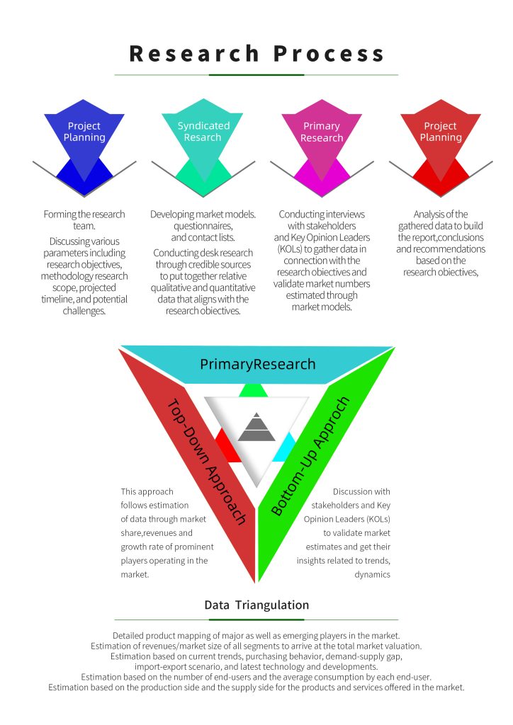
Challenges include sharing data across borders and dealing with different data protection rules. Geopolitical tensions also affect global geospatial information sharing and teamwork, as depicted in the image below.
RECENT REPORTS
Our clients